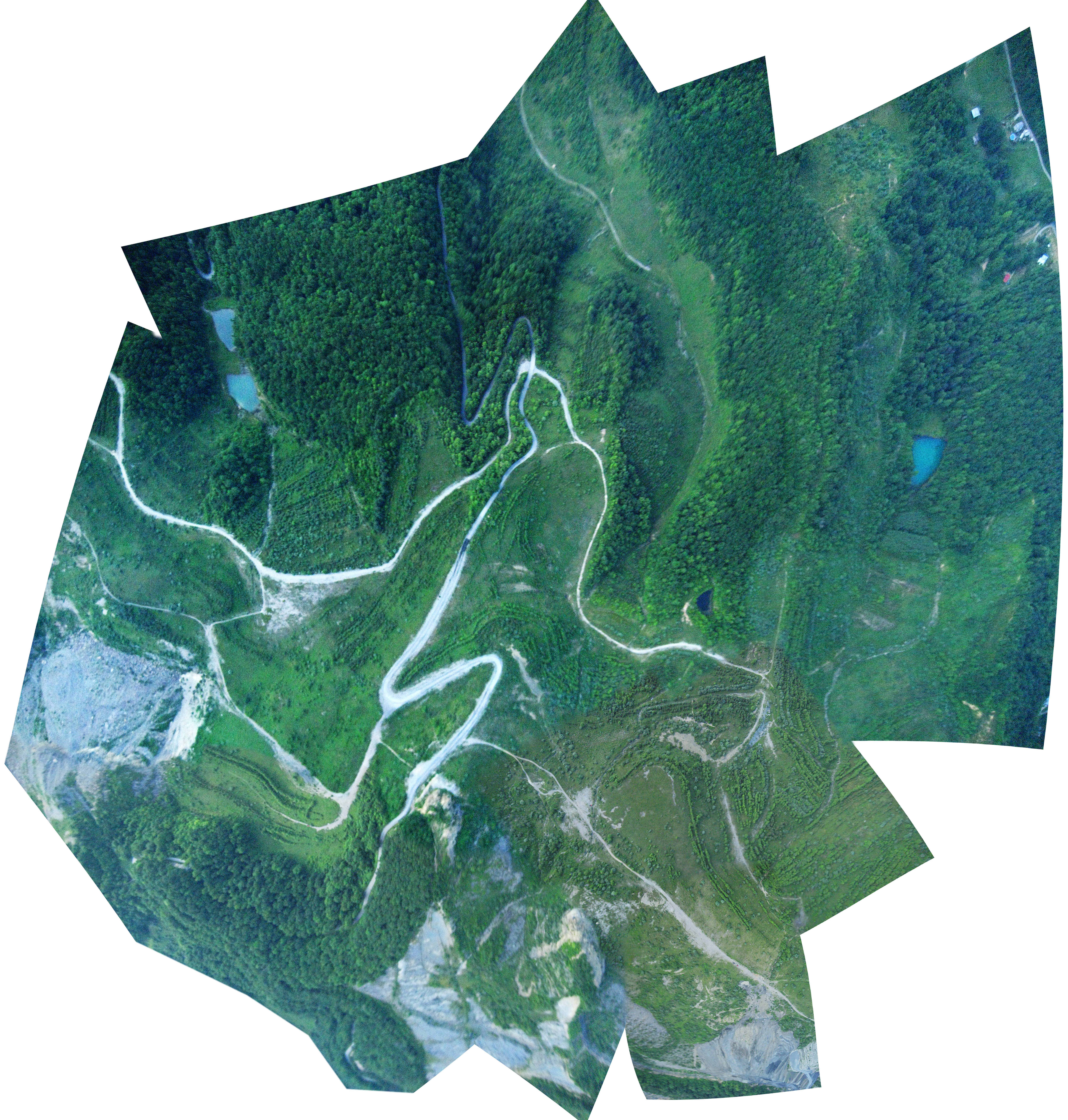
Black Mountain, Virginia
Mapped by Jeffrey Warren, Stewart Long
Cartographer: Stewart Long
Published by gonzoearth
37.063315790603816 N, -82.66715706740194 E
301 views
Ground resolution: 28.0 cm/px
Capture date: 2010-05-30T00:00:00
Publication date: 2011-05-23T00:00:00
License: Public Domain
Mapped by Jeffrey Warren, Stewart Long
Cartographer: Stewart Long
Published by gonzoearth
37.063315790603816 N, -82.66715706740194 E
252 views
Ground resolution: 28.0 cm/px
Capture date: 2010-05-30T00:00:00
Publication date: 2011-05-23T00:00:00
License: Public Domain
Notes
Jim Wiley from wileyslastresort.com guided our mapping party out to the site in his 4x4 Jeep Wrangler. The purpose of the balloon mapping trial was to try balloon aerial mapping at a mountain top removal (MTR) reclamation site.
First, we had to create an improvised tether while in the field in order to fly high altitudes. In the somewhat rural area of Eastern Kentucky that we were in we had access to a farm supply store.
 Choosing from available parts at the farm supply store.
 The tether spool during construction.
Ready to map, we drove out to a MTR site across the Virginia State line.
The tether spool during construction.
Ready to map, we drove out to a MTR site across the Virginia State line.
 The site was only accessible via 4x4
 preparing the camera (image sensor) balloon payload
 Jeff Warren wrangling the balloon back down to Earth
Cartographer notes
This project had both sufficient aerial base map availability and high altitude above ground level. Registering images with ground control was easier on this map. The imagery did have noise from the image sensor, but there was also noise in the form of mist from clouds. -Stewart
Notes
Jim Wiley from wileyslastresort.com guided our mapping party out to the site in his 4x4 Jeep Wrangler. The purpose of the balloon mapping trial was to try balloon aerial mapping at a mountain top removal (MTR) reclamation site.
First, we had to create an improvised tether while in the field in order to fly high altitudes. In the somewhat rural area of Eastern Kentucky that we were in we had access to a farm supply store.
Choosing from available parts at the farm supply store.
The tether spool during construction.
Ready to map, we drove out to a MTR site across the Virginia State line.
The site was only accessible via 4x4
preparing the camera (image sensor) balloon payload
Jeff Warren wrangling the balloon back down to Earth
Cartographer notes
This project had both sufficient aerial base map availability and high altitude above ground level. Registering images with ground control was easier on this map. The imagery did have noise from the image sensor, but there was also noise in the form of mist from clouds. -Stewart
1 Comments
Partial hypr3d model from this dataset:
http://www.hypr3d.com/models/4fd64bb8b6d8810001000033
Reply to this comment...
Log in to comment
Login to comment.