Chandeleur Islands, Louisiana
Mapped by , Shannon Dosemagen, Stewart Long, Mariko Toyoji
Cartographer: Stewart Long
Published by warren
29.802910103410355 N, -88.86611555841014 E
390 views
Ground resolution: 8.31 cm/px
Capture date: 2010-05-09T00:00:00
Publication date: 2010-05-16T00:00:00
License: Public Domain
Mapped by , Shannon Dosemagen, Stewart Long, Mariko Toyoji
Cartographer: Stewart Long
Published by warren
29.802910103410355 N, -88.86611555841014 E
327 views
Ground resolution: 8.31 cm/px
Capture date: 2010-05-09T00:00:00
Publication date: 2010-05-16T00:00:00
License: Public Domain
Additional photos from this trip can be viewed on Flickr:
https://flickr.com/photos/tags/may9chandeleurmap
Here's a video of Jim from UptownAngler.com, who offered the boat to get to the Chandeleur Islands. They're about 40 miles offshore.
And here's a video of a helicopter landing on a sandbar, scaring away pelicans as the balloon mappers observe:
Notes
Jim from uptownangler.com
This was a full day of field work! The boat set out from the port of Venice and it was a long rough ride out to the Chandeleur going out, and coming back. Nobody on board got ill, bu the boat was slowed by choppy seas throughout the day.
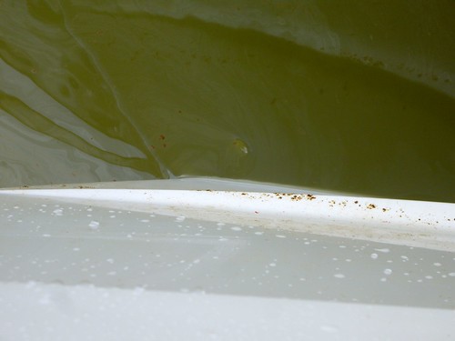
 While it was windy at times, the team found calm ballooning friendly conditions at mid day when the flight took place. The chemical dispersants were most dominant from our ground perspective while out along the Chandeleur. It was a chemical smell that I was not familiar with, something like gasoline fumes.
 The actual flight was up at around 1,500' and was a gentle and prolonged drifting of the balloon and boat with the anchor not deployed.
-Stewart
The actual flight was up at around 1,500' and was a gentle and prolonged drifting of the balloon and boat with the anchor not deployed.
-Stewart
Cartographer notes
Special thanks to Jim from uptownangler.com
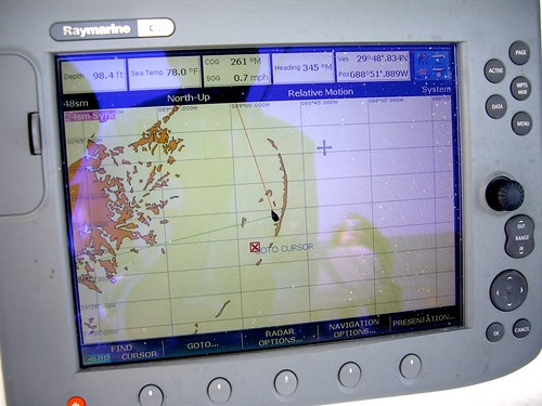
The balloon flight drifted along with the boat for about a half hour of continuous shooting inside the Chandeleur barrier island chain. While we observed visible oil and chemical dispersants in the water during the whole time we were out there, the extent of the mapping area was determined by the presence of ground control among the aerial images and GPS tracks.
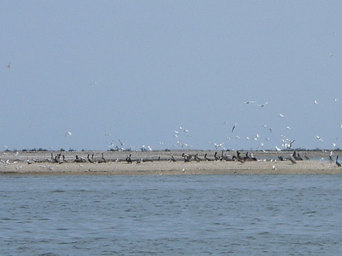
This map is of an area in the Chandeleur where a cut has formed in the barrier island landform. There is visible reef rock, sand bar, and sand spit. The rainbow color is visible oil sheen on the surface of the water. There is also heavy oil pollution within the san spit, and in the wave action along the sandy beach. Brown Pelican (LA State bird) and Sandwich Tern are identifiable in the SE portion of the map. The Captain Jim's boat is also in the scene.
The imagery was post-processed to reduce exposure and bring out more information in general that was thinned out in the histogram from water, glare, and beach.
-Stewart
Notes
Jim from uptownangler.com
This was a full day of field work! The boat set out from the port of Venice and it was a long rough ride out to the Chandeleur going out, and coming back. Nobody on board got ill, bu the boat was slowed by choppy seas throughout the day.
While it was windy at times, the team found calm ballooning friendly conditions at mid day when the flight took place. The chemical dispersants were most dominant from our ground perspective while out along the Chandeleur. It was a chemical smell that I was not familiar with, something like gasoline fumes.
The actual flight was up at around 1,500' and was a gentle and prolonged drifting of the balloon and boat with the anchor not deployed.
-Stewart
Cartographer notes
Special thanks to Jim from uptownangler.com The balloon flight drifted along with the boat for about a half hour of continuous shooting inside the Chandeleur barrier island chain. While we observed visible oil and chemical dispersants in the water during the whole time we were out there, the extent of the mapping area was determined by the presence of ground control among the aerial images and GPS tracks.
This map is of an area in the Chandeleur where a cut has formed in the barrier island landform. There is visible reef rock, sand bar, and sand spit. The rainbow color is visible oil sheen on the surface of the water. There is also heavy oil pollution within the san spit, and in the wave action along the sandy beach. Brown Pelican (LA State bird) and Sandwich Tern are identifiable in the SE portion of the map. The Captain Jim's boat is also in the scene.
The imagery was post-processed to reduce exposure and bring out more information in general that was thinned out in the histogram from water, glare, and beach.
-Stewart
1 Comments
I've been looking for public domain reference imagery, and wrote a while ago about this here: https://publiclab.org/notes/warren/3-19-2012/rough-placement-chandeleur-map
Anyhow, I found this map layer (you have to toggle the layers a bit to see them together):
Is this a question? Click here to post it to the Questions page.
Reply to this comment...
Log in to comment
Login to comment.