Mapped by MicheleTobias , Stewart Long, Liz Barry, Alex, Alex Mandel
Cartographer: Stewart Long
Published by gonzoearth
38.54131381021589 N, -121.74877877967893 E
408 views
Ground resolution: 3.33 cm/px
Capture date: 2011-11-21T00:00:00
Publication date: 2011-11-23T00:00:00
License: Public Domain
Mapped by MicheleTobias , Stewart Long, Liz Barry, Alex, Alex Mandel
Cartographer: Stewart Long
Published by gonzoearth
38.54131381021589 N, -121.74877877967893 E
303 views
Ground resolution: 3.33 cm/px
Capture date: 2011-11-21T00:00:00
Publication date: 2011-11-23T00:00:00
License: Public Domain
The plastic bottle that is visible in the video is the second camera, which is taking still images. The video was captured with a mobile phone camera.
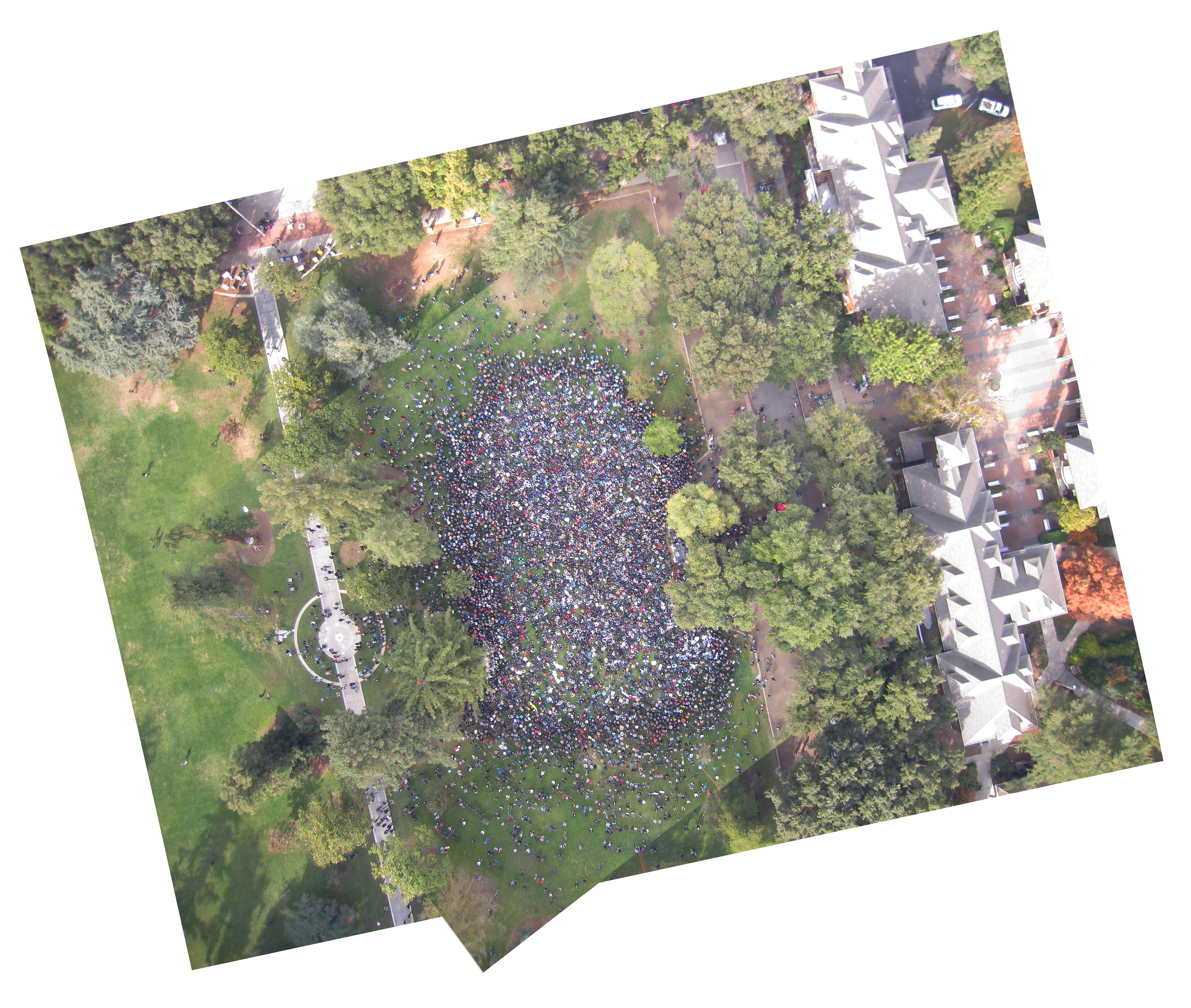
It was quite foggy at noon when we began. We set the exposure for the foggy weather, and were restricted to flying around 300ft until later in the flight when the sun broke through. At that point we went up to 500'.
The best imagery was from early in the flight before the sun came out. I selected one image that had the majority of the crowd and overlaid it on-top of imagery from later in the flight when we were able to fly higher as the fog dissipated and the sun broke through. I intentionally used one image for most of the crowd so that a somewhat accurate count can be done. Although there were lots of people obscured from view behind all of trees.
1 Comments
Occupy
Reply to this comment...
Log in to comment
Login to comment.