
Contribute
We’re so glad you’re here, thanks for your interest in getting involved with Public Lab! 👋🏽 🎈
Public Lab is an open community -- you're welcome to simply start contributing in a variety of ways. Check out some examples of different ways to contribute below and get started with any that interest you. Whether you’re looking to connect with people at public events, ask or answer questions, develop and test tools or software for environmental research, or write about community science, there’s something for everyone! 🙋🏽 By contributing to the Public Lab community, you’ll be building shared knowledge on environmental issues and the ways that we can address them together.
Please read and follow Public Lab’s Code of Conduct, which ensures a respectful space for everyone 💚
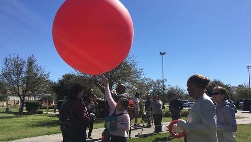
Lead image: Balloon mapping at the Texas Barnraising, photo by @zengirl2
On this page:
Getting started with contributing
If you’re new to Public Lab, here are some first activities to try:
Getting more involved with the community
And here are some ways to further engage and contribute to the Public Lab community. Any of these activities are great for a group! 😀 Doing this together can make the work easier and more fun. Find resources on organizing group events here or reach out if you have questions!
Contributing to software and code
A wonderful community of coders and developers contribute to Public Lab everyday by supporting our website infrastructure and open source software programs. Check out the links below if you’d like to get involved, newcomers are welcome and encouraged to join!
- Learn more at the Public Lab code community welcome page here: https://code.publiclab.org/
- Visit the Public Lab chat room and see who's currently also online.
- Check out some of the software that Public Lab maintains: MapKnitter, Infragram, and Spectral Workbench. See more about software and developers here: https://publiclab.org/wiki/developers
Contributing to hardware
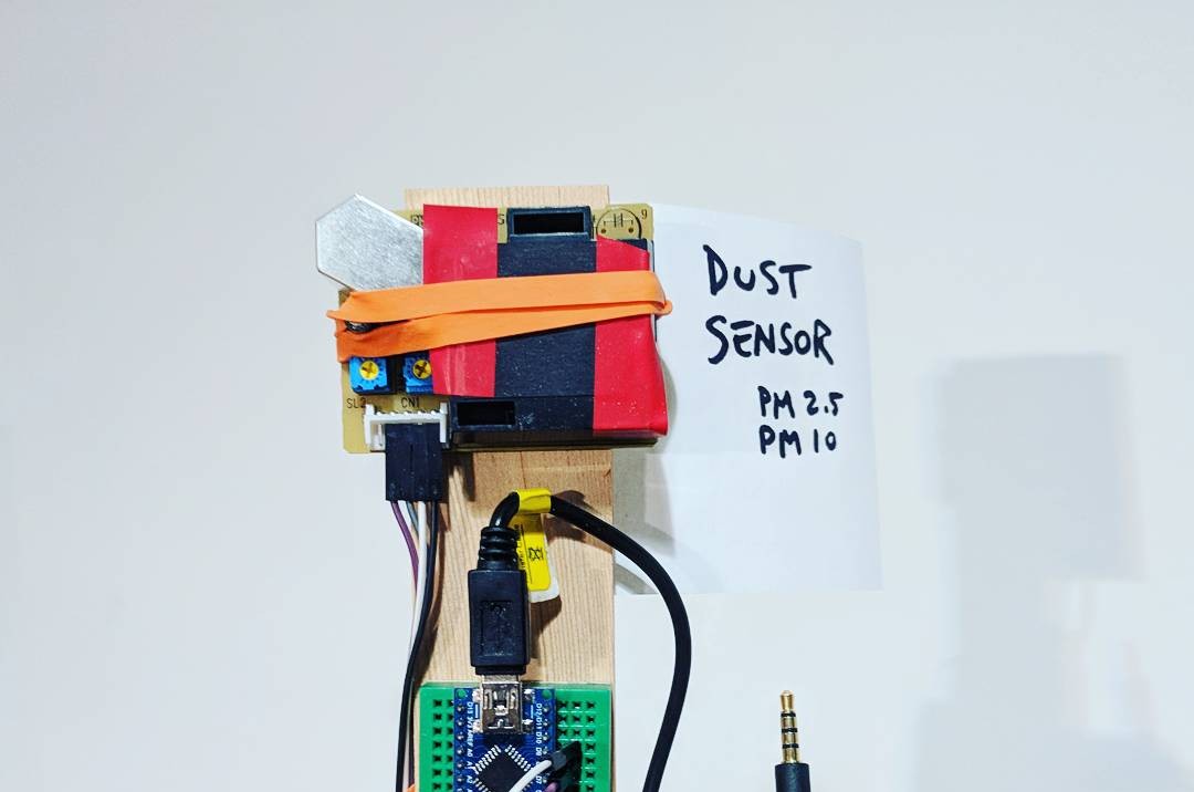
Image: @warren
Some of the activities listed above involve testing and documenting methods and tools for community science, but there’s much more you can do!
- Our Community Kits program is designed to support the creation of new tools, kits, and resources by inviting designers, developers, researchers, tinkerers, community organizers, inventors (and anyone else who is interested) to consider working with the Public Lab Kits Initiative to develop, produce, and distribute your open source research tools!
- Have you purchased a kit from the Public Lab store? You can help improve the kit by sharing on PublicLab.org: How did the assembly go? How have you used the kit? Do you have any ideas for improvements? Did you use any Public Lab software to collect or analyze data from your kit?
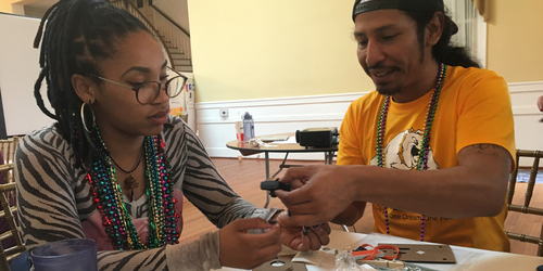
For educators
Image: @a1ahna
If you’re an educator or someone who works with schools, universities, or public workshops, there are some additional ways to get involved with Public Lab.
- Adopt and add to curriculum listed on the Education wiki.
- Share any curriculum you’ve made that uses or is inspired by activities on Public Lab.
Make the case for community science
Do you have a knack for writing or fundraising? Help spread the word about community science and build more capacity for it by co-authoring papers and grants.
- Write articles and papers (in research journals, newspaper op-eds, magazines, etc.) with other community members.
- Co-author grants for funding research and for working with specific communities.
Benefits of contributing
✔️ By answering questions, commenting on research, improving information on community science methods, or offering insights on advocacy strategies, you’ll be supporting communities investigating local environmental issues;
✔️ Build a body of public research online and receive credit for your work. Your profile page will feature all your work on Public Lab;
✔️ Enable others to learn from your findings, progress, and challenges. Sharing what didn’t work is as helpful as sharing what did work;
✔️ Receive feedback on your research;
✔️ Find collaborators for research;
✔️ Build and apply skills and knowledge of interest to you: writing, documentation, building and making, law and policy, and much more!
✔️ Participate in any way you can, as much or as little as you’re able. All of it matters!
✔️ Find community with other people that care about environmental health and justice.
Image: @warren
Resources on using the Public Lab website
- Website basics: https://publiclab.org/wiki/website-basics
- How to use and improve this website: https://publiclab.org/wiki/website
More to come!
Resources related to contributing on Public Lab


Questions? Want to learn more?
Looking for more help? Or interested in a more formal collaboration? Email staff@publiclab.org
Thank you!
We hope you’ll join the Public Lab community in creating shared knowledge together! ❤️💡