Community Science Forum
Read about cutting edge techniques in hacking environmental science in our Community Science Forum, our research journal/archive/zine/map where we share ideas, techniques, and stories.
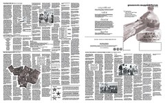
The Community Science Forum is printed on a 22.75x35" sheet of acid-free paper, and includes a full-color reproduction of our projects along with essays, illustrated guides, and interviews. It's a great way to stay abreast of the latest in the DIY environmental science movement.
Links provided to online versions of most articles.
Through 2019, most issues of the Community Science Forum were designed by longtime Public Lab collaborator Maria del Carmen Lamadrid, who has generously agreed to make the template available under CC-BY-SA license. Download available here.
Click here to purchase a subscription
Issue 18 Student-Led Community Science Projects (Summer 2021)
Download the PDF »
Read the Articles
Introduction to Student-Led Community Science Projects
Household Recycling in New Orleans
Collecting Microplastics in City Park
Observing Potholes in Louisiana
Calculating a Trash Estimate in the Mississippi River through New Orleans
Challenges and Solutions doing Fieldwork
Soil Contamination in St. John the Baptist Parish
Issue 17 Cranston Print Works (Fall 2019)
Download the PDF »
Read the Articles
Introduction to Cranston Print Works
How a Leader and a Community Saved the Sprague Mansion
Recipes for Dyes: Chemicals, Metals, and Acids at Cranston Print Works
A Wintry Kite Mapping at Cranston Print Works
Issue 16 Odor Logging (Spring 2019)
Download the PDF »
Read the Articles
Smell and Evocative Instrumentation: The history of measuring odors
Novel Methods for Assessing Industrial Odors
Putting Odor Issues on the Map: Using citizen science to curb odors in the EU
How to Use a Transect, illustrated by Sara Sage
How to Describe Odors Using FIDO, illustrated by Sara Sage
Issue 15 Gulf Coast (Late fall 2018)
Download the PDF »
Read the Articles
Educating a New Generation of Advocates
Recharging New Orleans: Rain Barrels and Environmental Justice
The Africatown Connections Blueway: Legacy and Rebirth
Sustain the Nine: Resilience in the Lower Ninth Ward
Fighting the Flood: Community Activism and Education in Pensacola
Issue 14 Crisis Convening (Fall 2018)
Download the PDF »
Read the Articles
Show You Can be Free in a Colony
For Us, by Us: A Network of Support for Puerto Rico
The Importance of Community-based Responders
Issue 13 Changing Environmental Governance Landscape (Fall 2017)

Download the PDF »
[[Order a copy »]]
Read the Articles
How is the changing environmental governance landscape affecting your work? by Public Lab Staff
Back to basics, or a departure from environmental protections? History lends perspective by Leif Fredrickson, Environmental Data and Governance Initiative
Silver linings of community science by Gretchen Gehrke, Public Lab
What's happening with government agencies' environmental justice work? by Jill Lindsey Harrison, Associate Professor of Sociology, University of Colorado-Boulder
Let public lands speak for themselves by George Dusenbury, GA State Director, The Trust for Public Land
Roll up your sleeves and fight regulatory rollbacks by Stacy Shelton
Activate impact: fund boldness by Jake Mogan, The 11th Hour Project
Washington is one of many paths to sustainability progress. Green buildings can help by Jeremy Sigmon, Director, Technical Policy, U.S. Green Building Council
Issue 12 Water (Winter 2017)

Download the PDF »
[Order a copy »]
Read the Articles
Photo Documentation of Frac Sand Mine Surface Water Spills by Lee Boland
Hydraulic Fracturing and the Rebirth of Citizen Water Monitoring in the U.S by Kirk Jalbert, Manager of Community-Based Research & Engagement, FracTracker Alliance
The Riffle: DIY and Open Source by Don Blair and Mathew Lippincott
Pollutant Discharge Permits by Gretchen Gehrke
A Sensor Journalist's Story by Jillian Clemente
What happens when we use timelapse to monitor blasting at mine sites? by Public Lab Staff
Issue 11 Frac Sand (Spring 2016)

Download the PDF »
[Order a copy »]
Read the Articles
What happens when the mining stops? Focus on Reclamation by Gretchen Gehrke, Mathew Lippincott and Cheryl Miller
History of Community Air Monitoring in Western Wisconsin by Mathew Lippincott
Airborne Silica and Regulations by Gretchen Gehrke
Interview with Pat Popple by Stevie Lewis
Visual Reporting on Air Quality: EPA Method 9 by Stevie Lewis
Using Photographs in Fighting Mining Companies by Forest Jahnke, Crawford Stewardship Project
Local Knowledge and Aerial Imagery by Mary Kenosian
Documenting Runoff with Photography by Gretchen Gehrke
Issue 10 DIY Oil Testing (Winter 2016)

Download the PDF »
Order a copy »
Read the Articles
Announcing Spectral Workbench 2 by Jeffrey Warren
DIY Oil Testing by Jeffrey Warren , Stevie Lewis and Gretchen Gehrke
Using the Oil Testing Kit with Gulf Coast Communities by Stevie Lewis
DIY Oil Testing Narratives by Ann Chen
Oil Sheen Testing by Matej Vakula
Spectometer Intensity Calibration by Yagiz Sutcu
Collecting Oil Sheen on Newtown Creek, Dutch Kills, Queens, NY by Matej Vakula and nameiswillis
Issue 9 Land Management Issue (Oct 2015)

Download the PDF »
Order a copy »
Read the Articles
Photo Monitoring Plugin for NDVI Using Image J by Ned Horning
FarmHack by Dorn Cox and Severine von Tscharner Fleming
PhotoSynq by Greg Austic
Planet Leafiest (Nighthawk Panorama and Return to Planet LEAFFEST) by Chris Fastie
Issue 8 The Urban Waters Issue (July 2015)

Download the PDF »
Order a copy »
Read the Articles
About the Urban Waters Project
An Ode to Maps by Diana Di Leonardo
Announcing Mapknitter 2.0 by the Web Working Group
Issue 7 The 5 Year Anniversary Issue (May 2015)

Order a copy »
Download the PDF »
Read the Articles
Public Lab Five Year Retrospective by Shannon Dosemagen
How to Get Involved with Public Lab illustrated by Molly Danielsson
A History of Crediting Hardware Contributions by Mathew Lippincott
Coder Crisis: Attracting Software Developers to Public Lab by Justin Manley, Bryan Bonvallet, Jeff Warren, and Molly Danielsson
Issue 6 The Waste Issue (Q3 2014)

Issue 6 explores trash in all its many forms.
Order a copy »
Download the centerfold featuring an activity for estimating the volume of your local landfill
- A full color map or the Trans-Load America Pondview Waste Facility.
- Touch, Collect, Display, Order, Mesasure, Map, Inflate, and Build with Waste! by (Pablo Rey Mazón, Basurama)
- Mapping Waste When Waste is Invisible (Max Liboiron)
- Detritivore Design (Mathew Lippincott)
- Connecting with our Landfills (Nicholas Johnson)
- Estimating the Volume and Weight of Waste (Holden Sparacino)
- Saugus Ash Landfill, MA (Pablo Rey Mazón)
- 3D Modelling Waste Piles with SFM (Pat Coyle)
Issue 5 The International Issue (Q2 2014)


Issue 5 is focused on highlighting the Public Lab community around the world. It's also our first edition printed in color.
Order a copy »
Download a PDF copy of the Map of Silwan
- Full color map of Silwan, Jerusalem created through participatory mapping with children from Silwan.
- La Valld'Uixó cover by Basurama (Pablo Rey Mazón and Rubén Lorenzo) using MapKnitter.
- Thoughts on Better Tools for Mapping from Hagit Keysar in Jerusalem.
- Interview with Pablo Rey Mazón, developer at montera34.com and waste researcher with Basurama by Shannon Dosemagen
- Exploring Science Beyond Exams in Hong Kong by Fan Lok-yi
- Mapping along the Rio Hondo River in Belize by Pat Coyle
- Tools for Stalling Eviction by María del Carmen Lamadrid.
Issue 4 (fall 2013)

Issue 4 is focused on long term research in the New York City chapter.
Order a copy »
- Full color maps featuring sewage overflows in the Gowanus Canal and oyster reef restoration in the Bronx River
- Tracking recreated wetlands in Jamaica Bay with Gena Wirth and the Dredge Collective
- Jamaica Bay cover illustration by Gena Wirth
- Interview with founding board member and New York City research lead Eymund Diegel by Shannon Dosemagen
- Two-tether mapping method by Natasia Sidharta
- GLAM Mission by Hans Hesselein
- Five Borough Farm by Philip Silva and Liz Barry
- and much more!
Issue 3 (spring 2013)

Issue 3 is an in depth look at community organizing in the Public Lab community.
Order a copy »
- A full color, wall-ready map of downtown Oakland and of UC Davis during the Occupy protests with notes from the cartographer and mappers
- An interview with citizen scientist organizer Cindy Regalado (Shannon Dosemagen)
- Protest Mapping (Oscar Brett)
- Organizing Public Lab (Shannon Dosemagen)
- Open Sourcing Jerusalem? (Hagit Keysar)
- Barnstars! (Liz Barry)
- Civic and Citizen Science: the Cocodrie Barnraising heats up (dialog from the Public Lab 2012 Barnraising)
Issue 2 (summer 2012)

Order a copy »
- A full color wall-ready map of the Chandeleur Islands with notes from the ground and bios of the mappers.
- UAS Ethics: A dialogue on Unpiloted Aerial System (drone) ethics between privacy lawyers, drone developers, and balloon-loving grassroots mappers. (ed. Mathew Lippincott, including Amie Stepanovich and Coby Leuschke)
- DIY Near-Infrared Imaging (Chris Fastie and Jeff Warren)
- An interview with Scott Eustis of the Gulf Restoration Network (Shannon Dosemagen)
- Quick, fun activities you can do to get involved in Grassroots Mapping!
Issue 1 (summer 2011)
Sold out!
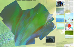
- A full color wall-ready map of an island in Barataria Bay showing oil spilled from the Deepwater Horizon Oil Spill
- An interview with Gulf Coast resident Barbara Marcotte (Shannon Dosemagen
- Details on how to get started balloon or kite mapping (Jeff Warren)
- Reimagining the data lifecycle by Shannon Dosemagen and Jeff Warren
Pre-press version (not the final edition which went to press): gmf-1-prepress-small.pdf
Get involved
Learn about and get involved in writing, editing, publishing, promoting, and distributing the forum on the forum planning page.
Using Content from Grassroots Mapping Forum
The Forum is a Creative Commons Attribution Share-Alike licensed document. If you'd like to use content from it, go ahead! Mathew can provide high-res artwork and original files if those are helpful to you, just send an e-mail to mathew@publiclab.org.
 CSF17.pdf