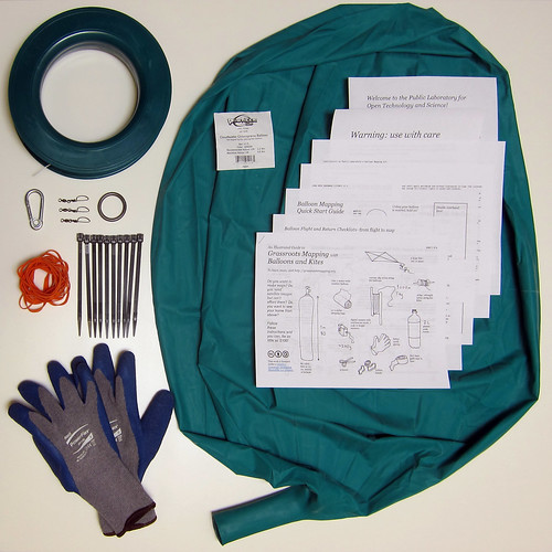
Balloon Mapping Kit
This kit, offered for sale by Public Laboratory's nonprofit arm, is the result of experiments in DIY balloon mapping. They were available through the Balloon Mapping Kits Kickstarter and now online through Breadpig.
Balloon Mapping Kits in the Public Lab store »
The kit is based on the more in-depth description of balloon mapping kit materials here: http://publiclaboratory.org/wiki/balloon-mapping-materials
Useful links
- MapKnitter for stitching your aerial photos into online/digital maps
- The Public Laboratory Archive - a repository of open data maps produced mostly with balloons and kites, by independent "grassroots mappers"
- Register on this site to take part in the growing Public Laboratory open source community and get support from other balloon mappers
- Kite mapping is a good alternative to balloons in areas where helium is hard to come by
- Check out near-infrared photography for using your kit with an additional infrared camera to analyze vegetation
Each kit contains:
- A Qualatex 5.5' (170cm) "Cloudbuster" Chloroprene balloon
- latex/chloroprene (neoprene) mix, making it UV resistant, fairly tear resistant, and excellent at retaining helium. Two-four days of flights can be had with one filling of helium.
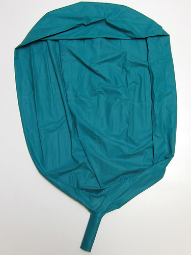
- latex/chloroprene (neoprene) mix, making it UV resistant, fairly tear resistant, and excellent at retaining helium. Two-four days of flights can be had with one filling of helium.
A custom-wound 8" or 9" hoop winder and 1000' (300m) of 110lb (50kg) line, from Shanti Kites
- We tracked these back to the factory and are having them custom wound. No other winder is sold with more than 500' of line.
- We tracked these back to the factory and are having them custom wound. No other winder is sold with more than 500' of line.
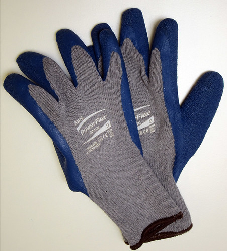
A pair of cotton work gloves palm-coated with rubber to get a grip while bringing the balloon in and prevent rope burns.
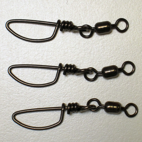
- Three 170lb Coastlock Mighty-Mini Snap Swivels we use these because they're the only ones that are lead free (one spare)
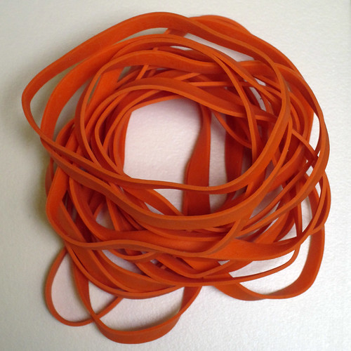
- Twenty #64 latex-free rubber bands. We use these because they don't get brittle in the cold like latex rubber bands. They are for the camera rig (one spare)
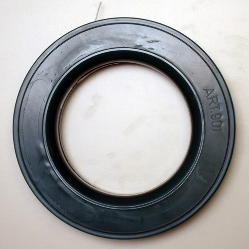
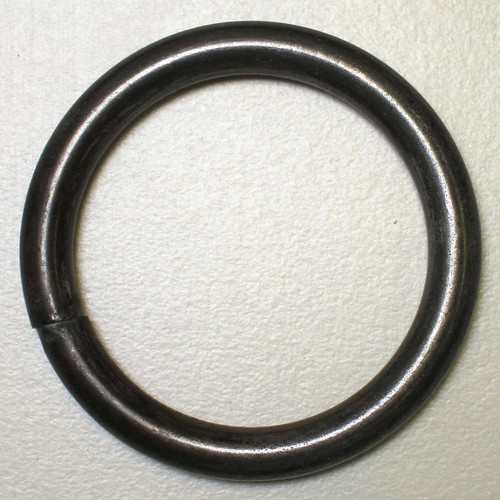
- 1.25" diameter steel ring for attaching the balloon to the line.
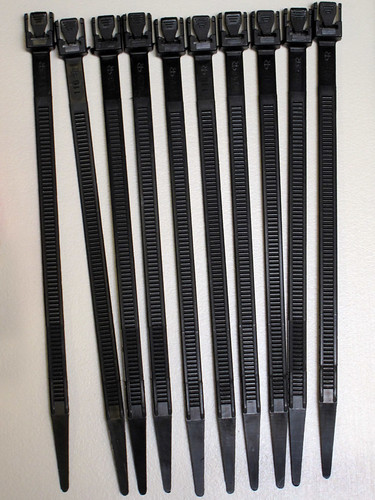
- Ten reusable cable ties for closing the balloon.
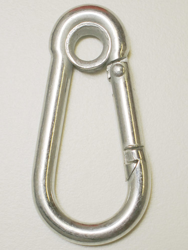
- A carabiner for mooring.
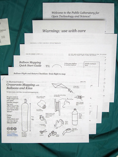
*Documentation
The kit ships with paper documentation. (all available on the Guides page for download) The latest editions of:
- Grassroots Mapping Guide
- Balloon Mapping Quick Start Guide
- Balloon Mapping Flight Checklists and Packing Lists
- Kit contributors list
- CERN Open Hardware License
- Legal Indemnity & Safety warnings
- Welcome to Public Laboratory getting started page
- (not for first KS shipping, but for later kits?) a 1 page Flight Log
Weights
This is important for shipping/online sales: SKU, Description, Weight * BPIG-PLOTS-125RING 1.25" Dia. Steel Ring = .05 lbs. * BPIG-PLOTS-CABTIE 5.5" Reusable Cable Tie = <.05 lbs. * BPIG-PLOTS-CARAB GalvanizedSteel eye-ring Carabiner = .05 lbs. * BPIG-PLOTS-ELASTF #64 Latex Free Rubber Bands = <.05 lbs. * BPIG-PLOTS-LGLOVE Cotton Work Glove, Palm-Coated with Latex, Large = .10 lbs. * BPIG-PLOTS-NEOBAL 5.5' Chloroprene Balloon = .70 lbs. * BPIG-PLOTS-REEL 8" Hoop Winder with 1000ft 110# line = 1.10 lbs. * BPIG-PLOTS-SWIVL 170# test Mighty Mini All-Stainless Snap Swivel = <.05 lbs.
= 2.15 lbs total
Shipping costs end up being:
- UPS Ground: $6.23
- USP 3-day select: $17.63
- USP 2nd day air: $25.77
- USP next day air: $63.18