Balloon & Kite Mapping
Balloon mapping is a low-cost way to take aerial photos using a camera, attached to a balloon, on a spool of string. People have done this from a few hundred feet up all the way to over 4,000 feet in the air.
Our whole toolkit is linked out below, but really fast:
- Assemble your own, buy our balloon kit, or buy/make a kite.
- find a good camera.
- determine how you will trigger the camera, (we suggest a rubber band) or pick out a timelapse app for your smartphone.
- build a simple housing from a plastic bottle.
- find a site to map that is five miles from an airport and not Washington D.C. (or learn about the regulations yourself)
- follow the pre-flight checklist(pdf) and quickstart guide(pdf) to safely fill up your balloon and fly!
- maneuver your balloon at your site
- sort your images on your desktop (Mac,Windows) or with Mapmill.
- make them into a map with Mapknitter.
- Print a poster of your map from Mapknitter, see your map join the public record in our archive, and if you'd like, even in Google Earth.
Activities
Activities should include a materials list, costs and a step-by-step guide to construction with photos. Learn what makes a good activity here.
Questions about balloon mapping:
Browse maps and data generated with this technique in the Public Laboratory Archive
Browse Research Notes on Balloon Mapping
A short video by Mathew Lippincott on setting up and launching your balloon.
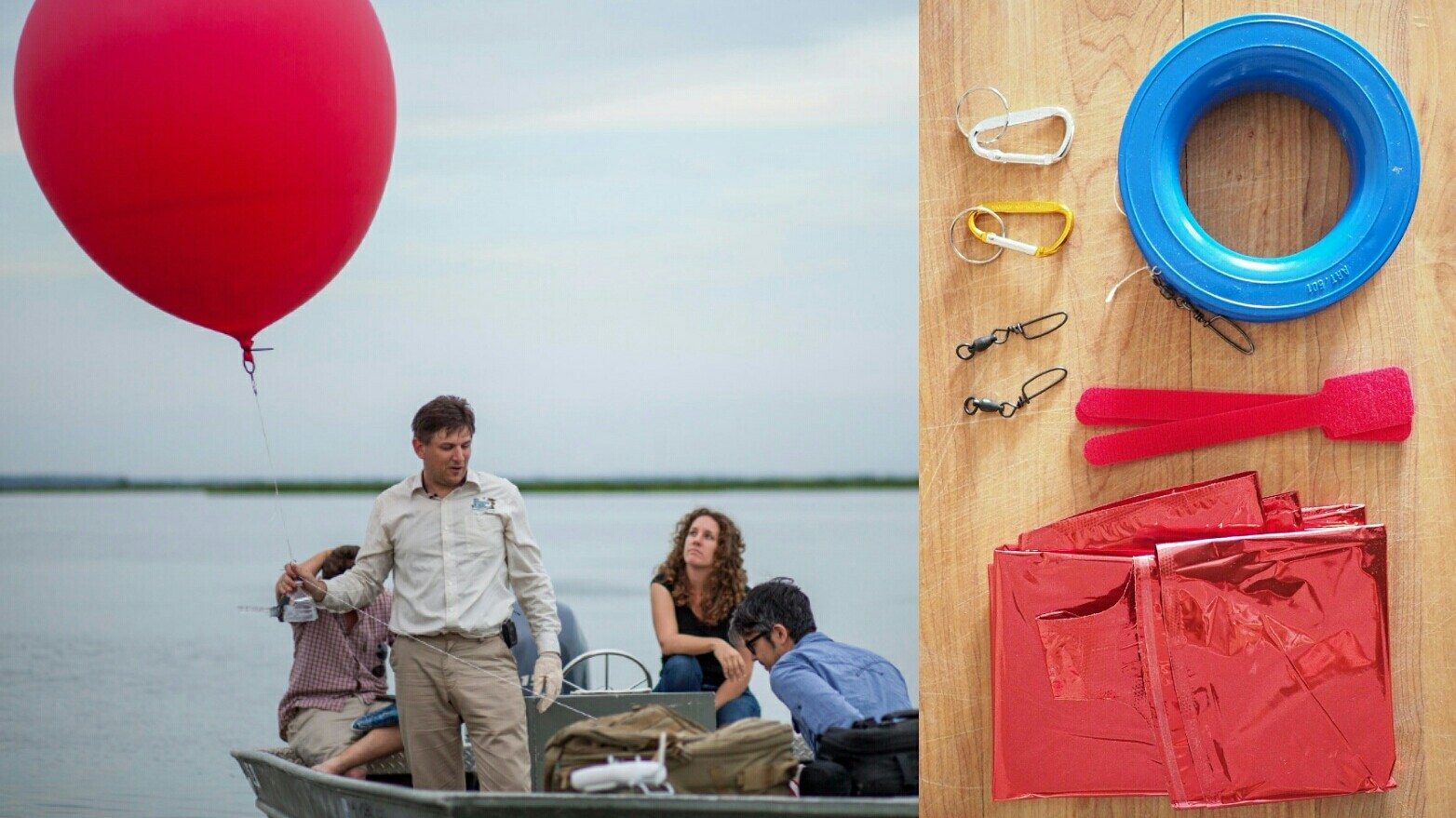
Grassroots Mapping Toolkit
Our aerial mapping toolkit is a simplified kite and balloon aerial photography system for easy and accessible high-resolution map-making. The tookit consists of:
Flight platforms: Assembling a balloon kit will cost from $100-200, including helium.
The Public Laboratory Balloon Mapping Kit is assembled from our preferred parts.
For alternative and low-cost materials, see the Balloon Mapping Materials page.
Camera housings: Single Line systems: The PET Bottle & Rubber Band Rig wraps around the small and medium sized cameras (up to micro 4/3) for crash protection while firmly mounting it in a position for vertical images.
For heavy cameras, a Trash Can Rig offers more protection.
Multiple Line Systems: these are more complex to build but can provide added stability, especially useful for video. Several people have created Picavet rigs.
Cameras: A small camera that supports continuous shooting mode and a large storage card, or an excellent camera phone are our preferred options.
Help selecting a camera
Different ways of triggering the camera shutter
The PicaPiKAP a Raspberry Pi based mapping camera.
Mapmaking software: Public Laboratory's MapKnitter is easy to use browser software for map making. Continue on to MapKnitter Guide and MapKnitter Help for more information.
When mapmaking, efficient image sorting either on your desktop, or using Mapmill is a must.
Some people also use proprietary software such as Photoshop, Hypr3d, or PhotoSynth. For a freely distributed desktop option, check out the GNU Image Manipulation Program.
Useful guides: Our latest guides can always be found on the Guides page, including:
The four-page Grassroots Mapping Guide
The Balloon Mapping Quick Start Guide to filling and flying (pdf) and editable Google Doc
The Balloon Mapping Check Lists (pdf) and editable Google Doc, which are extremely useful in planning field expeditions, even for experienced fliers.
We also maintain a guide to FAA regulations page.
Curricula and workshops: Our Curriculum-Guide covers the entire process and some theory behind mapping. It is still in beta.
Advanced Techniques
- Near-infrared imagery for vegetation monitoring and other uses.
- Image analysis - Try some of these techniques for bringing out detail and compositing your images with near-infrared imagery.
- Ground control point targets for correlating on-the-ground measurements directly with photos.
- Balloon telemetry for recording GPS and gyroscopic data.
- Kite Balloons experiments in wind-stabilized balloons
- Hydrogen ballooning - be very careful!